Bathygraphic is a fancy term for an underwater contour map. As fishermen we find this information quite useful, as they let us find structure, like drop offs or old stream beds, where fish like to hang out. If we are fishing deep they let us know where to expect it to start shallowing up, so we can bring in our gear and avoid getting hung up.
The problem is that good map data is hard to find.Until recently you had to rely on data from a map pack like those offered by Navionics. In my experience those maps were primarily focused on navigation, and lacked the detail needed for effective fishing.
This is because the maps are based on limited survey data and then the space between the actual survey points are extrapolated.
And that is assuming data even exists for the lake you are interested in at all!
Here is an example of a Navionics map for American Lake
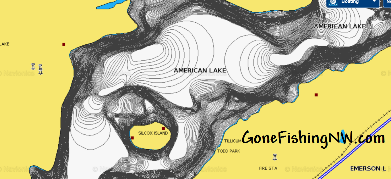
This map certainly shows us where drop offs are, which is great, but just how nice and smooth all this looks betrays the artificialness of the data.
In the past it was certainly impractical to expect a company to completely survey the thousands of lakes which exist in each state.
Now technology has provided an alternative to relying on expensive survey equipment and operators.
Modern fish finders have reached incredible levels of detail in the sonar signal and processing. Combine this with a GPS, and we have everything we need to perform our own surveys.

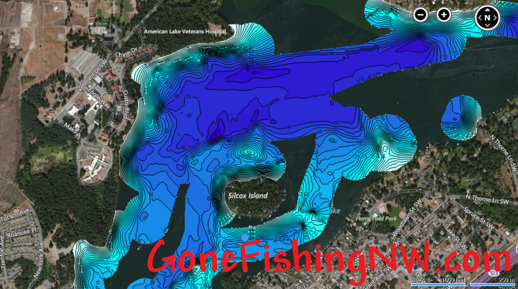
Lowrance realized this and launched a website called Insights Genesis, which is the first crowd sourced bathygraphic mapping solution.
You can take your saved GPS/sonar data and upload it to their web site. They then take that raw data, combine it with other people’s data, process it and create what they call the “Social Map”.
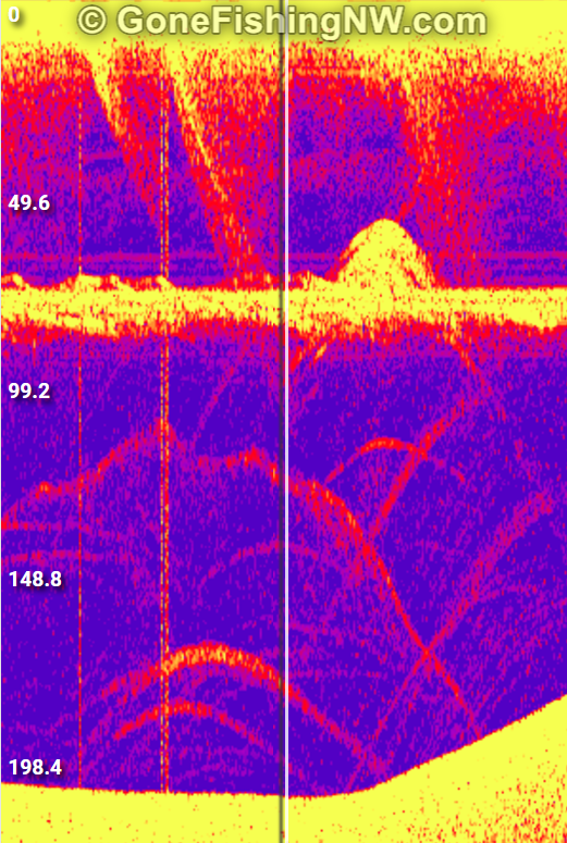
Here is an example for the same section of American Lake that we previously looked at:

As you can see the level of detail is significantly better. We see all the jaggedness and irregularities we expect in the real world.
We can now download this map into our fish finder to have available as we are fishing.
This system isn’t perfect by any means, and I think Lowrance is being a bit misleading in offering 1 foot contour data. Downsides to the data include:
- Data only exists for areas of the lake people have collected and shared data for
- Differences in GPS antenna/transducer placement result in inaccuracies (i.e. in one boat the transducer and antenna might be a foot apart, in another they might be 10 feet apart)
- Water level fluctuates over time in a lake, causing different sonar traces to have different data
Even with these downsides this is a tremendous improvement in map data for places I fish.
To contribute and consume data please refer to the Insights Genesis web site. Your fish finder will need to be a finder + chartplotter model (sonar + GPS), and have an SD card. You may need to apply a firmware update to be fully compatible.
I hope to see our local waters get mapped out as more and more people participate in this.
Good luck and tight lines!

1 thought on “Create Custom Bathygraphic Maps”
Comments are closed.